KEMRON, under a five year, $85M task order under the Huntsville WERS contract is conducting multiple studies of Advanced Geophysical Classification system application at Fort Ord, California under a task order with the USACE Sacramento. The following information is a brief update on the findings and conclusions of recent and ongoing activities.
The Munitions with Sensitive Fuzes Field Study conducted at Range 48 at Fort Ord was designed to compare the performance of the Geonics EM61 and the White River Technologies OPTEMA Advanced Geophysical Classification (AGC) system for locating 40mm HE projectiles in the near subsurface (0-12 inches bgs). DGM detection surveys were conducted with both the OPTEMA and EM61, and all detection targets were intrusively investigated to provide ground truth for the field study. The OPTEMA sensor was used in dynamic mode with dynamic data being used for anomaly detection. The detected target locations were then analyzed to classify the anomaly sources as targets of interest (TOI), which would require intrusive investigation and removal, or non-TOI, which could be safely left in place. Detection targets not selected by the OPTEMA sensor but located by the EM61 were added to the OPTEMA target list to compile the final detection target list. Although a total of 11 acres were geophysically surveyed, because the anomaly density was found to be extremely high (2499 anomalies per acre) the area of investigation was subdivided into three (3) 25’x25’ grids that were used for the field study. A total of 412 DGM anomalies were selected as initial detection targets in these 3 grids. The dynamic OPTEMA AGC sensor data was then used to reduce the number of detection targets from 412 to 129 TOI. This is a 68.7% reduction in the number of targets that would need to be excavated in a production (non-field study) investigation. Of these 129 anomalies classified as potential TOI, a total of 44 MEC or MEC-like (inert) items were located.
The Munitions with Sensitive Fuzes Field Study conducted at Unit 23 at Fort Ord was designed to compare the performance of the Geonics EM61 and the Geometrics MetalMapper 2×2 (MM2x2) AGC system for locating 40mm HE projectiles in the near subsurface (0-12 inches bgs). DGM detection surveys were conducted with both the MM2x2 and EM61, and all detection targets were intrusively investigated to provide ground truth for the field study. The MM2x2 was used in both dynamic and cued mode, with dynamic data being used for initial anomaly detection. Cued MM2x2 measurements were then acquired at the detected target locations, and the cued data were analyzed to classify the anomaly sources as TOI, which would require intrusive investigation and removal, or non-TOI, which could be safely left in place. Detection targets not selected by the MM2x2 sensor but located by the EM61 were added to the MM2x2 target list to compile the final detection target list. A total of 1.1 acres were geophysically surveyed. A total of 1814 DGM anomalies were selected as initial detection targets. The MM2x2 classification analysis reduced the number of detection targets from 1814 to 375 TOI. This is a 79.3% reduction in the number of targets that would need to be excavated in a production (non-field study) investigation. Of these 375 anomalies classified as potential TOI, a total of 3 MEC and 6 MEC-like (inert) items were located.
The Risk Reduction in Units 11 and 12 conducted at Fort Ord was designed to remove large ordnance items (155mm and 8” projectiles) from the near subsurface (0-1 ft bgs and 0-2 ft bgs (area dependent)) prior to a controlled burn. This Risk Reduction used both the Geonics EM61 and the Geometrics Metal Mapper (MM) AGC system. The EM61 was used for initial anomaly detection over 468 acres that comprised Units 11 and 12. A total of 4625 anomalies were identified with the EM61 that were indicative of potential large MEC items (155mm and 8” projectiles) in the near subsurface. Cued MM measurements were then acquired at the detected target locations, and the cued data were analyzed to classify the anomaly sources as TOI, which would require intrusive investigation and removal, or non-TOI, which could be safely left in place. The MM classification analysis reduced the number of targets to be intrusively investigated from 4625 to 589. This is an 87.3% reduction in the number of targets requiring excavation. Of these 589 anomalies classified as potential TOI, a total of 237 MEC and MEC-like (inert) TOI were located. In addition to the recovered TOI, 437 non-TOI munitions items smaller than the risk reduction TOI were recovered from the intrusive investigation locations.
The Risk Reduction in Unit 23 conducted at Fort Ord was designed to remove large ordnance items (155mm and 8” projectiles) from the near subsurface (0-1 ft bgs and 0-2 ft bgs (area dependent)) prior to a controlled burn. This Risk Reduction used both the Geonics EM61 and the Geometrics MM2x2 AGC system. The EM61 was used for initial anomaly detection over 368 acres that comprised Unit 23. A total of 1217 anomalies were identified with the EM61 that were indicative of potential large MEC items (155mm and 8” projectiles) in the near subsurface. Cued MM2x2 measurements were then acquired at the detected target locations, and the cued data were analyzed to classify the anomaly sources as TOI, which would require intrusive investigation and removal, or non-TOI, which could be safely left in place. The MM2x2 classification analysis reduced the number of targets to be intrusively investigated from 1217 to 242. This is an 80.1% reduction in the number of targets requiring excavation. Intrusive investigation of the 242 anomalies classified as potential TOI is currently scheduled.
The Remedial Action at the area known as Broadway Bypass at Fort Ord was designed to locate and remove all MEC items to depth. This Remedial Action used the TEMTADS AGC sensor in both dynamic and cued mode over a 2 acre area. A total of 5021 detection anomalies were initially identified with the TEMTADS. Cued TEMTADS measurements were then acquired at the detected target locations, and the cued data were analyzed to classify the anomaly sources as TOI, which would require intrusive investigation and removal, or non-TOI, which could be safely left in place. The TEMTADS classification analysis reduced the number of targets to be intrusively investigated from 5021 to 2175. This is a 56.7% reduction in the number of targets requiring excavation. Of these 2175 anomalies classified as potential TOI a total of 50 MEC and MEC like (inert) items were located.
The Remedial Action at Unit B-2A at Fort Ord was designed to locate and remove 4.2-inch mortars to a depth of 18 inches bgs. This Remedial Action used the Geonics EM61 and the Geometrics MM2x2. The EM61 was used for initial anomaly detection over 73.5 acres that comprise Unit B-2A. A total of 749 anomalies were identified with the EM61 that were indicative of potential 4.2-inch mortars in the near subsurface. Cued MM2x2 measurements were then acquired at the detected target locations, and the cued data were analyzed to classify the anomaly sources as TOI, which would require intrusive investigation and removal, or non-TOI, which could be safely left in place. The MM2x2 classification analysis reduced the number of targets to be intrusively investigated from 749 to 69. This is a 90.8% reduction in the number of targets requiring excavation. Intrusive investigation of the 69 anomalies classified as potential TOI is in progress.
The Remedial Action at the Vernal Ponds at Fort Ord was designed to locate and remove all MEC items to depth. This Remedial Action used the Geonics EM61 and the Geometrics MM2x2. The EM61 was used for initial anomaly detection over 11 acres that comprised the Vernal Ponds. A total of 1007 anomalies were identified with the EM61 that were indicative of potential subsurface MEC. Cued MM2x2 measurements were then acquired at the detected target locations, and the cued data were analyzed to classify the anomaly sources as TOI, which would require intrusive investigation and removal, or non-TOI, which could be safely left in place. The MM2x2 classification analysis reduced the number of targets to be intrusively investigated from 1007 to 436. This is a 56.6% reduction in the number of targets requiring excavation. Intrusive investigation of the 436 anomalies classified as potential TOI is currently scheduled.
KEMRON was awarded a five-year, $84 million CPFF and FFP hybrid task order to clean up munitions and explosives of concern (MEC) and hazardous and toxic waste (HTW) in site soils at the former Fort Ord in Monterey, California. The scope of work includes mechanical and manual clearing of vegetation, prescribed burning of vegetation, surface MEC removal, subsurface MEC removal, digital geophysical mapping, advanced classification geophysics, and removal, certification, and recycling of munitions debris (MD) and range-related debris. Various other work tasks within the scope include provision of an Administrative Records Coordinator in the Army’s BRAC office on site, managing several complex databases, managing two project websites, preparing the CERCLA 5-Year Review report, and performing various erosion control projects across the former Impact Area. KEMRON is managing this program under our earned value management system with a WBS structure of several hundred unique tasks and associated cost codes.
The following major work elements (projects) comprise the work under this contract: Impact Area Munitions Response Area MEC Remediation; Bureau of Land Management Area B MEC Remediation; Basewide Range Assessment (HTW soil remediation); Erosion Control at Various Range Sites; various Restoration projects: Advanced Classification Geophysics remediation and technology pilot study projects; MMRP Database, GIS and Website Management; and Biological Support.
KEMRON has performed both mechanical and manual mastication of planned fuel breaks for planned prescribed burns in the former Impact Area and nearby Bureau of Land Management (BLM) Area B. Through 9/17, over 600 acres of containment lines have been cleared of vegetation using two subcontractors with Feller Bunchers and two subcontractors with 7-8 person manual cutting teams. Manual cutting also included significant brush clearing and tree limbing of canopies up to 8 feet above ground surface, so that the risk of “crowning” during prescribed burns would be minimized. All manually-cut vegetation was collected and stockpiled for two different chipping operations. Chipped material has been reused all across the Impact Area for various erosion control projects.
KEMRON has completed all field work at Impact Area Unit (IA) 5A (33.4 acres), Unit 09 (81 acres), Unit 11 (62 acres), Unit 12 (107 acres), Unit 23 (347 acres), Unit 25 (95 acres), and Unit 28 (101 acres). We have completed portions of the following IA units: Unit 31 (57 acres), Unit 13, (17 acres), Unit 17 (4 acres), and Unit 20 (10 acres). KEMRON has recently completed performing field work for a portion of BLM Area B, Unit A (55 acres), and primary containment lines for future prescribed burns in BLM Unit B (81 acres) and Unit C (64 acres). The work in these units included vegetation cutting, grid/boundary staking, and surface MEC removal. DGM is now ongoing in these units. Also ongoing is the completion of 2 cut-only units in BLM Area B, Unit B-2A (72 acres) and Unit B-3 (169 acres). KEMRON has also finished preparations for the prescribed burning of up to 5 units in 2017, including containment line preparation, aerial and ground support staffing, wildland fire training, dip tank and piping/pumps setup, and coordination with the Army. These complex and extensive burn preparations were completed precisely on the schedule established several months ago to be “burn-ready.”
KEMRON has completed the digital geophysical mapping (DGM) of over 720 acres in the Impact Area and BLM Area B since the inception of the project. A towed array with three EM-61 sensors is utilized to prepare the subsurface anomaly maps that are eventually provided to the BLM and used for decision making regarding subsurface MEC removal efforts. Some person-portable DGM surveys have also been conducted in areas of special biological concern (eg, ponds) and to gather information around obstructions that was not able to be collected with the towed array assembly (eg, tree clusters).
KEMRON has performed several subsurface MEC removal projects on Fort Ord, including the Unit 23 New Access Routes, Units 1, 2, and 3 New Fuel Break Roads, Chinook Road Fuel Break Expansion, Nowhere Road Realignment, and Little Moab Road Construction. To date, over 330,000 pounds of MD have been removed, sorted, and certified for offsite smelter recycling, and 4,300 MPPEH items have now been collected and destroyed/to be destroyed in the course of numerous demolition operations, both consolidated shots and blow-in-place shots.
KEMRON employs an extensive quality control (QC) program to assure accurate and complete field activities and data collection. USACE’s 3-phase QC process is employed for every field activity in each Impact Area or BLM Area B unit, beginning with the conduct of a thorough preparatory meeting. All field personnel and managers, including client representatives, attend these kickoff meetings, and a detailed agenda covers specific work task processes, procedures, governing documents, biological protection issues, and safety issues. As the work proceeds, the required series of inspections from initial to final work stages by the project’s Contractor Quality Control Systems Manager (CQCSM) with client representatives is performed and documented.
For munitions cleanup QC, the project Unexploded Ordnance Quality Control Supervisor (UXOQCS) places QC seeds in near-term grids to be cleared with a target find rate of 1 QC seed per team per day. Through 9/17, spanning a period of 2.25 years, a total of 1,485 QC seeds have been recovered by KEMRON’s UXO teams with zero misses. The QC seed recovery rate to date has been 0.95 QC seeds found per team per day. In addition, 630 QA seeds, placed by USACE’s OESS, have also been recovered by KEMRON’s teams without any misses to date. The UXOQCS also personally sweeps a minimum of 10% of the grids by all teams as a further QC check on completeness, and he continually observes and coaches field team leaders and individual technicians on surveying techniques.
Prescribed burning for vegetation removal is a large part of the KEMRON scope of work for Fort Ord. All major burn subcontractors have been procured through KEMRON, including Burn Boss, Air Ground Operations Supervisor, air-ground communications, ignition and suppression helicopters, wildfire ground crews and fire engines, water trucks, other equipment, dip tank management staff, security staff, UXO staff, and others. When a meteorological window (for optimum smoke behavior to minimize local impacts) presents itself, KEMRON has only 48 hours to assemble the entire burn support team on site, with key partners coming from as far away as central Oregon. KEMRON’s Burn Boss and ASGS work closely with the Incident Commander, the Presidio of Monterey Fire Chief, on burn day operations.
KEMRON has successfully completed the innovative subsurface remediation of large, near-surface ordnance items in Units 11 and 12 using advanced classification (AC) geophysics (Metal Mapper) in order to safely conduct burns of these units. That AC project included 688 target excavations and the subsequent removal and destruction of numerous large and medium-sized ordnance items. Other AC projects to complete remedial actions involving TEMTADS and Metal Mapper 2×2 are ongoing.
USACE has included significant erosion control and range restoration projects within the KEMRON scope of work. Many of these projects have already been completed, with most including clearance of ordnance to depth prior to beginning site earthwork. KEMRON has also completed construction of the approximately 1-mile long Little Moab Road in BLM Area B. This roadway was brand new construction over some challenging, hilly terrain, and the project included some adjacent erosion control measures to protect nearby biological resources and preserve the roadbed for a longer period of time. In conjunction with the Army and BLM, KEMRON designed the road alignment and then performed the earthwork, base compaction, rock placement, and final grading in the field.
KMERON is also engaged in HTW cleanup activities at Fort Ord. The Basewide Range Assessment (BRA) program is a final step after the completion of MEC remediation activities to carefully examine site soils for both lead and explosives contamination. A combination of historical site research, known range usage, current site features, other site reconnaissance, and then, if warranted, multi-composite soil sampling a varying depth intervals is conducted to thoroughly examine the potential for HTW contamination. Through 9/17, KEMRON completed evaluations of 2 IA units (with 1 successfully petitioned for no further action without any sampling), was currently evaluating soil sampling results for 1 unit, and was preparing sampling work plans for 3 additional units.
KEMRON was contracted by the USAESCH to conduct a Remedial Investigation/Feasibility Study (RI/FS) for 13 Munitions Response Sites (MRS) at the former Camp Gordon Johnston (CGJ). Several distinct approaches were used to determine the nature and extent of munitions and explosives of concern (MEC) and munitions constituents (MC) at each MRS. KEMRON utilized “Mag and Dig”, anomaly count transects and digital geophysical mapping (DGM) to locate subsurface anomalies.
A Removal Action (RA) was conducted prior to the RI at three of the MRSs at the former CGJ. Due to the presence of munitions near the boundaries of two of these MRSs, KEMRON proposed that “Mag and Dig” transects be conducted in a radial pattern to further delineate munitions at these MRSs. In addition, soil and groundwater samples were collected inside these MRSs to determine if MCs were present. KEMRON successfully determined the nature and extent of MEC and MC contamination at each site.
KEMRON developed the unique approach of using anomaly count transects to determine areas where there was an elevated density of subsurface anomalies. By using this approach, DGM grids could be surveyed in areas where there would be an increased likelihood of locating munitions items. This method was also used at two MRSs that were identified as small arms ranges. In addition to the information collected from the anomaly count transects, KEMRON identified physical features of a firing range to identify areas where soils samples were collected and analyzed for lead.
One of the most challenging MRSs was the Alligator Point Gunnery Range due to the fact that the MRS covered both land and water totaling 3,689 acres. The water portion of the MRS was in the Gulf of Mexico and encompassed approximately 3,500 acres. KEMRON oversaw the work of two subcontractors in order to perform the underwater DGM investigation and diving operations. KEMRON designed an approach that identified concentrated areas of MEC and MD by conducting preliminary transects to locate potential concentrations of munitions. Based upon the results of the intrusive investigation of identified anomalies, follow up transects and subsequent intrusive investigations were conducted to determine the extent of the MEC contamination. Due to the presence of protected bird and turtle species, field activities at this MRS were conducted during periods that were less likely to interfere with nesting activities of these species. As a result of the RI at this MRS, a presumed target area was identified and the proposed boundary of the MRS was reduced to approximately 800 acres.
KEMRON arranged the Technical Project Planning (TPP) meetings and successfully coordinated with the residents and business owners within the CGJ investigation area. The goals of the RI were accomplished at each of the MRSs with minimal disruption to the residents in the investigation area.
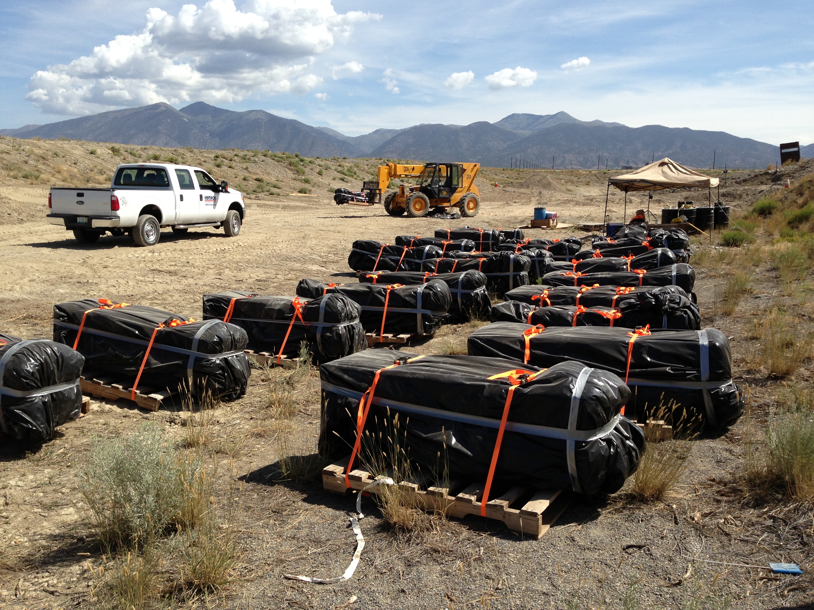
KEMRON completed a CR TO under the Huntsville Worldwide Environmental Remediation Services (WERS) Multiple Award Task Order Contract (MATOC). The performance objective was to achieve Response Complete at Solid Waste Management Unit (SWMU) 2 at the Deseret Chemical Depot in Stockton, UT (now known as Tooele Army Depot-South). SWMU 2 was an area contaminated with discarded military munitions (DMMs) and possible chemical weapons munitions (CWMs) and other military devices as well as a suspected burial trench containing both DMM and CWM. KEMRON completed the removal of contaminated soils, material potentially presenting an explosive hazard (MPPEH), and disposition of all recovered material through disposal or destruction. Final confirmatory sampling confirmed Response Complete.
SWMU 2, a 10-acre parcel in the southwest portion of the Chemical Munitions Storage Area at Deseret, was historically used for the disposal of munition-related items to include conventional weapons as well as suspected mustard agents and other chemical munitions. KEMRON collaborated with the Edgewood Chemical and Biological Center (ECBC) and Chemical, Biological, Radiological or Nuclear Analytical and Remediation Activities (CARA) to provide field support for safety during intrusive and removal action activities. KEMRON prepared the work plan for this removal action, an APP, a Chemical Safety Submission (CSS) to the Department of Defense Explosives Safety Board (DDESB).
Digital geophysical mapping (DGM) techniques were employed to identify single point anomalies as well as the location of the suspected burial pit and delineate the boundaries of this disposal area. Prior to any intrusive activity, the KEMRON team underwent pre-operational training and drills with oversight and approval by Edgewood Chemical and Biological Center (ECBC) and CARA. Emergency personnel and evacuation equipment were present at all times during this removal action.
The disposal trench defined during the DGM study covered an area of approximately 50 ft by 300 ft. Fifteen ft of overburden was removed from the trench prior to encountering DMM. Once the overburden was removed, KEMRON recovered 112,243 Atlas squibs, 704 E46 cluster bomb units (CBUs) 1,448 M1 and M4 Smoke Pots, 2,589 M2 Smoke Candles, 640 M6 CN/DM grenades, and an assortment of fuses and boosters. All DMM was carefully removed, repackaged, and stored in existing bunkers to await final disposal. Contaminated soil recovered during this removal action was stockpiled and segregated pending final disposition. Contaminated soil (5,000 yards) was transported off-site for disposal at a Subtitle D disposal facility. Thermal destruction of the smoke pots, grenades, and candles was originally proposed as an on-site operation but the presence of chemical agents (arsenic) and stringent air discharge criteria ultimately precluded this process. These units were packaged and transported to a licensed incinerator for final disposal. The CBUs were destroyed on-site. KEMRON designed a burn chamber consisting of an open top 20-yd3 container. A flex liner shape charge (FLSC) was attached to each CBU to open the unit and facilitate burning. The CBU was packed in dunnage along with an ignitor and smokeless powder. The shape charge and squib were ignited simultaneously to initiate the burn unit and subsequent CBU detonation. 704 CBUs were destroyed in a system of eight burn chambers.
Confirmation sampling in order to achieve Response Complete included surface soil samples, wall and floor samples from the disposal pit, direct push technology soil boring for subsurface sample retrieval and field test equipment including PIDs for organics, x-ray fluorescence (XRF) for metals and Miniature Continuous Air Monitoring Systems (MINICAMS) for CWM. In-field screening and segregation of recovered soil resulted in the identification of over 3,000 yards of soil that could be used as backfill.
Air modeling was conducted in support of the proposed thermal destruction of the smoke pots, grenades, and candles. The air modeling was completed in accordance with Utah Division of Air Quality (UDAQ) Rule R307-410 and EPA Guidelines on Air Quality Models addressing air emissions associated with the use of burn pans and open detonation. The results of the modeling effort provided quantification of the amount of munitions that could be detonated and burned on-site.
A conceptual site model (CSM) and associated data quality objectives (DQOs) were developed to support the conclusion of Response Complete identifying sources, media, pathways, receptors, COCs, analytical methods, and risk-based decision points. EPA RSLs and site-specific soil to groundwater values were derived to establish attenuation factors. This risk-based approach reduced the volume of soil requiring disposal by over 50%.
A large part of this contract is for the on-site burn operations designed for the destruction of more than 750 CBUs. Due to safety concerns, it was necessary to move all personnel away from the burn pans to a distance of more than 800 ft which prevented monitoring of the operation. KEMRON worked with the installation to obtain permission to use a drone to fly over the burn pans and video the operation. This allowed USACE, the installation, and KEMRON to evaluate all aspects of the burn without compromise to safety.