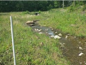
Boggs Creek

Under Contract to the U.S. Navy, KEMRON provided excavation and dewatering services for 1.3 miles of drainage canals, creeks and floodplains at NSA Crane, Indiana. KEMRON was tasked with the restoration of the canal and streams and their associated riparian habitats within highly sensitive areas within the waterways (and any adjacent, abutting, or isolated wetlands) of the project that were to be impacted by the project were coordinated with the regulatory branch of the U.S. Army Corps of Engineers (USACE) and the Indiana Department of Environmental Management (IDEM).
KEMRON maintained clear and open communication with all parties and agencies involved with this project. The Navy, IDEM, USACE, Indiana Department of Natural Resources Division of Water (IDNR-DOW), U.S. Fish and Wildlife and all other applicable parties to ensure any and all permitting requirements were met.
The scope of services included the preparation of the Work Plan, IDEM SWPPP and Rule 5 Stream Work Permit and COE 404 Permit; Stream Restoration Plan, Accident Prevention Plan/Site Safety and Health Plan and QC Plan; construction of a 1 mile long access road along the creek and canal; installation of silt fence; mobilization and site preparation; dewatering; and creek and canal excavation. Restoration work included the placement of cobbles, gravel and topsoil; installation of check-dams and log stops; coir matting, erosion control blankets and riprap; and seeding and planting.

The restoration plan included a stream and canal design showing general locations of restored features in addition to a list of recommended tree and herbaceous plant species that were indigenous and of local genotype blending in with and suitable for the immediate surrounding habitat. The plan also discussed appropriate measures for site preparation, specifications for correct installation of the plant material, and recommendations for post-installation maintenance. In addition, a riparian wetland on-site mitigation plan was incorporated the overall Restoration Plan.
KEMRON also completed a regulated waters delineation of the project area which included each stream reach and canal proposed for impacts and any associated riparian wetland boundaries using USACE criteria. The delineation included surveying the wetland/upland interface, average width and depth of each stream and canals ordinary high water mark (OHWM), preparation of a written report, and assembly of supporting materials documentation, as required by the USACE.
KEMRON installed a dewatering system utilizing both pump-around and Pipe-around techniques. We installed multiple dams, pumps and piping systems to dewater the stream and drainage canals in the areas to be excavated. Any considerable tributaries were dammed at the joining point.
Necessary clearing and grubbing was performed using a large excavator, a skid steer with mulching attachment and a chainsaw. Two land clearing crews were utilized and each began at the utility corridor staging area and worked away from each other. Large trees were felled by the large excavator and then the root ball was cut within 1 foot of its top. All cleared trees and brush was removed off-site.
Creek and canal excavation was performed using Track-Mounted Excavators and D-6 Dozers. Excavation started at the upstream limit of the work area and progressed downstream. Material was excavated and directly loaded into dump trucks for disposal. Excavation was performed within the defined configuration to the limits of excavation shown on the project drawings. Transitions in bottom width and elevation were uniform. Field measured cross-sections of the final embankments and creek and canal excavations were prepared by a Professional Surveyor Licensed in the State of Indiana.